NATIONAL HARBOR, Md. — The geopolitical theater of the 21st century is increasingly being observed, analyzed, and managed from low-Earth orbit. In recent public addresses, President Donald Trump has repeatedly spotlighted the United States Space Force’s sophisticated capabilities to monitor adversaries, specifically highlighting real-time surveillance operations over Iran.
"We see everything… because of Space Force," Trump declared in remarks earlier this month, drawing attention to the youngest branch of the U.S. Armed Forces. This followed statements in July, where the President discussed suspicious activities at Iran’s Pickaxe Mountain nuclear facility, asserting that the United States has "the greatest cameras in the world focused" on the region, leaving adversary movements with nowhere to hide.
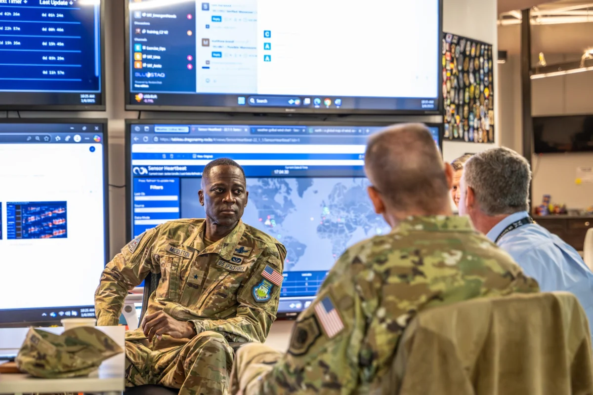
Behind these high-level political assertions lies a complex, rapidly evolving ecosystem of military hardware, intelligence partnerships, and cutting-edge artificial intelligence. At the Air & Space Forces Association’s (AFA) annual conference in National Harbor, Maryland, military leaders and defense technology executives gathered to discuss how the fusion of government spy satellites, commercial constellations, and AI-driven data synthesis is fundamentally changing the nature of geospatial intelligence (GEOINT).
Main Facts: The New Paradigm of Orbital Surveillance
The modern intelligence apparatus no longer relies solely on highly classified, multi-billion-dollar government satellites. Instead, it is characterized by a hybrid architecture that blends exquisite national security assets with agile, commercial space capabilities.
Several key developments define this current landscape:
- Synergy Between Space Force and the NRO: Confronted with questions regarding the executive assertion that the U.S. "sees everything," Gen. Douglas Schiess, the Space Force’s Chief of Space Operations, emphasized the deeply integrated relationship between the Space Force and the National Reconnaissance Office (NRO). The NRO designs, builds, and operates the nation’s premier spy satellites, while the Space Force provides the operational framework, launch capabilities, and space domain awareness necessary to protect and leverage these orbital assets.
- The Transition from Access to Analysis: Industry leaders argue that the primary bottleneck in modern intelligence is no longer obtaining imagery, but processing it. With thousands of commercial and government satellites capturing terabytes of data daily, the strategic advantage has shifted to organizations that can ingest, contextualize, and analyze this information the fastest.
- AI-Driven Workflow Automation: Companies like Danti, an Atlanta-based software firm, are deploying advanced AI search and synthesis tools to help defense analysts query massive databases of orbital information using natural language. This technology has progressed from simple image search to autonomous report generation, significantly compressing the time required to brief combatant commanders.
- The TacSRT Program’s Expansion: The Space Force’s Tactical Surveillance, Reconnaissance, and Tracking (TacSRT) program has emerged as the primary pipeline for delivering unclassified, commercially sourced intelligence directly to theater commanders. This allows for rapid, shareable intelligence dissemination that bypasses traditional, slow-moving security classification systems.
Chronology: The Evolution of Tactical Space Intelligence (2019–2026)
To understand the current state of orbital surveillance, it is necessary to trace the convergence of military space operations and commercial technology over the last several years:
December 2019: The Birth of the Space Force
The U.S. Space Force is established as an independent military branch. Its initial mandate focuses heavily on space superiority, satellite communications, and defending U.S. orbital assets from adversarial anti-satellite (ASAT) threats.
2021–2023: The Commercial Remote Sensing Boom
Commercial Earth observation companies—such as Maxar, Planet, and BlackSky—rapidly expand their constellations. Synthetic Aperture Radar (SAR) and high-resolution optical imagery become widely available on the open market. The Pentagon realizes it must leverage this commercial boom to keep pace with global data generation.
Mid-2024: Launch of the TacSRT Initiative
The Space Force establishes the TacSRT program to address a critical vulnerability: the delay in getting classified satellite intelligence down to tactical commanders in the field. By utilizing unclassified commercial imagery, TacSRT enables commanders to share vital intelligence with international allies instantly, without the red tape of high-level security clearances.
May 2025: Formalizing the Space Force-IC Partnership
The Space Force and the broader Intelligence Community (IC) sign a landmark agreement formalizing operational boundaries and collaboration protocols for the TacSRT program. This milestone establishes a unified front for purchasing and utilizing commercial remote sensing data.

Late 2025 – Early 2026: Operational Deployment in Regional Conflicts
During heightened tensions and active conflicts involving Iran and its regional proxies, Pentagon analysts deploy advanced AI tools, including Danti’s semantic search platform, to monitor troop movements, missile launch sites, and nuclear facilities like Pickaxe Mountain.
September 2026: Validation at the AFA Conference
At the annual Air & Space Forces Association conference, Space Force leadership and private contractors confirm the successful integration of these technologies. Danti announces a $2.1 million contract expansion to scale its AI-driven intelligence tools across multiple U.S. combatant commands.
[2019: USSF Founded] ──> [2021-23: Commercial Space Boom] ──> [2024: TacSRT Created]
                                                                     │
[2026: Scaled AI Integration] <── [2025: Space Force-IC Accord] <────┘
Supporting Data: Overcoming the Geospatial "Data Deluge"
The sheer volume of data generated by modern orbital assets is staggering. Traditional intelligence methods, which relied on human analysts manually scanning individual satellite images for changes, are no longer viable at scale.
The Scale of the Data Problem
A single modern commercial satellite constellation can downlinked hundreds of terabytes of data per day. When combined with national technical means (NTM) operated by the NRO, the military is flooded with more imagery, radio frequency (RF) signals, and telemetry than human analysts could ever inspect.
| Data Type | Traditional Processing Time | AI-Enabled Processing Time | Primary Military Application |
|---|---|---|---|
| High-Res Optical Imagery | Hours to Days | Minutes | Battle Damage Assessment, Facility Monitoring |
| Synthetic Aperture Radar (SAR) | Hours (Requires Specialist) | Real-time | Night/All-Weather Surveillance, Target Tracking |
| RF & Signal Intelligence | Days | Minutes | Radar Emission Location, Communications Intercepts |
| Open-Source Intelligence (OSINT) | Continuous Manual Review | Automated Continuous | Contextualizing Satellite Imagery with News/Socials |
Expanding AI Integration
To tackle this challenge, the Space Force has turned to companies like Danti. Rather than using AI merely as a search engine to locate specific coordinates, the technology is now integrated deep into the operational workflow.
According to Jesse Kallman, CEO of Danti, the company’s AI platform functions by continuously monitoring incoming data streams—including satellite imagery, maritime transponder data (AIS), RF signals, weather patterns, and open-source news reports. The AI identifies anomalies, synthesizes the disparate data points, and automatically drafts an intelligence report for human review.
To support the expansion of these capabilities, the Space Force recently awarded Danti a $2.1 million contract expansion. This funding is aimed at deploying the software directly to operators within various U.S. Combatant Commands (COCOMs), such as U.S. Central Command (CENTCOM) and U.S. Indo-Pacific Command (INDOPACOM), where rapid decision-making is critical.
Official Responses: Balancing Classification and Innovation
The integration of commercial capabilities and AI into national defense has sparked a broader conversation about how the military balances classified intelligence with commercial agility.
The Military Perspective
Speaking to reporters at the AFA conference, Gen. Douglas Schiess emphasized that the Space Force’s strength lies in its collaborative posture.
"We can see a lot of things," Schiess remarked, addressing President Trump’s comments about Iran. "We are providing the capabilities that not only the president needs, but the intelligence community and our combatant commanders."

Schiess noted that the close relationship with the NRO ensures that when commercial data falls short, the nation’s highly classified, high-resolution assets can be steered to fill the gaps.
The Industry Perspective
Jesse Kallman, CEO of Danti, highlighted the rapid democratization of space-based intelligence, noting a dramatic shift over the last five years.
"I think space-based intelligence is becoming way more accessible to the common person, both commercially and in government," Kallman told SpaceNews. "When you can take space-based information and intelligence, contextualize it and add it into all the other forms of intelligence, it’s no longer this one thing that, many years ago, was more of a niche, highly technical area for a small group of subject-matter experts."
Addressing concerns about the reliability of artificial intelligence in high-stakes military environments, Kallman emphasized that humans remain central to the loop.
"The technology does not replace the analysts," Kallman reassured. Reports generated by Danti’s AI platform are clearly flagged as machine-generated and must undergo rigorous review and approval by human intelligence officers before being disseminated to commanders or decision-makers.
Implications: The Geopolitical and Tactical Consequences
The rapid advancement of AI-driven, commercial-military orbital surveillance has profound implications for global security, tactical warfare, and international diplomacy.
1. The Death of Strategic Surprise
With continuous, multi-spectrum orbital coverage powered by automated change detection, the ability of adversaries to conduct covert military build-ups or hide sensitive developments is severely degraded. As demonstrated by the public discussions surrounding Iran’s Pickaxe Mountain nuclear facility, state-sponsored projects are visible to orbital sensors almost from their inception. This near-continuous monitoring changes the calculus of deterrence, making surprise grey-zone operations highly difficult to execute.
2. Compression of the OODA Loop
The military decision-making cycle—Observe, Orient, Decide, Act (the OODA loop)—is being compressed from days to minutes. Traditionally, a commander’s morning intelligence briefing required analysts to work through the night, manually compiling reports. By automating the retrieval, analysis, and formatting of intelligence data, AI tools allow commanders to receive dynamic, real-time briefings that can be queried on the fly, enabling rapid responses to fast-moving battlefield developments.
3. Democratization of Space Intelligence
The reliance on commercial remote sensing and unclassified programs like TacSRT means that high-quality intelligence is no longer the exclusive domain of global superpowers. The United States can seamlessly share tactical intelligence with coalition partners, non-state allies, and international bodies without compromising classified collection methods. This democratization fosters stronger international coalitions and allows for greater transparency in holding rogue actors accountable on the global stage.
4. Future Challenges: Counter-AI and Space Denial
As the U.S. military becomes increasingly reliant on AI to process orbital intelligence, adversaries will likely pivot toward countering these specific technologies. This could manifest as physical space denial efforts—such as GPS jamming, directed-energy weapons, and anti-satellite missiles—or sophisticated spoofing techniques designed to fool AI computer vision models. Ensuring the resilience of both the physical satellite constellations and the digital pipelines that process their data will remain a paramount challenge for the U.S. Space Force in the years to come.