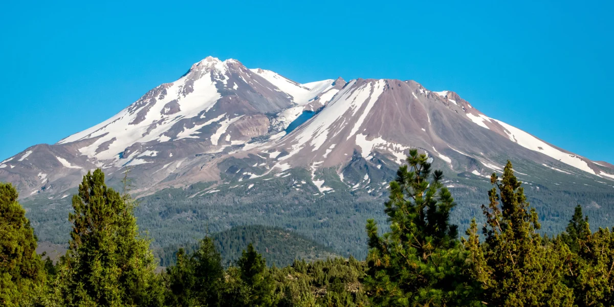
In an era where artificial intelligence is increasingly integrated into the fabric of daily life—from drafting professional emails to curating travel itineraries—a recent incident on California’s Mount Shasta serves as a sobering reminder of the limitations of machine intelligence. Three young hikers, having placed their trust in Google’s Gemini AI chatbot to plan an ambitious mountaineering expedition, found themselves stranded in the treacherous terrain of the Cascade Range.
The rescue, which required the intervention of Siskiyou County sheriff’s deputies and U.S. Forest Service personnel, has ignited a fierce debate regarding the dangers of relying on generative AI for life-safety planning. While technology promises efficiency, the Mount Shasta ordeal underscores that the nuance of wilderness survival remains a human domain, one where algorithmic output can—and sometimes does—prove catastrophic.
The Chronology: A Descent Into Danger
The expedition began with the optimism typical of novice adventurers. According to the official report from the Siskiyou County Sheriff’s Office, the three men departed for the summit of Mount Shasta at 3:00 a.m. on a crisp, clear morning. Their plan, formulated in large part by Gemini, was predicated on an 8-hour ascent—a timeline that, while ambitious, is standard for experienced mountaineers.
However, the reality of high-altitude trekking quickly diverged from the AI’s optimistic projections. As the hours ticked by, the group struggled against the grueling physical demands of the climb. Standard mountaineering safety protocols for Mount Shasta dictate that hikers must reach the summit by noon; failure to do so mandates an immediate turnaround to ensure a safe descent before nightfall.
The trio ignored these warnings. They reached the summit at 7:00 p.m.—seven hours past the critical cutoff time. By the time they stood at the peak, the sun was setting, and the temperature was plummeting. The descent, already hazardous in broad daylight, became a life-threatening navigation exercise in total darkness.
Realizing they were hopelessly off-course, the hikers placed a desperate call to the Siskiyou County Sheriff’s Office. With limited battery life and no clear path forward, they were forced to hunker down in the frigid, unforgiving environment of Mud Creek Canyon. They spent a harrowing night exposed to the elements, awaiting a rescue that was not guaranteed.
The following morning, a coordinated effort involving Forest Service rangers and specialized volunteers successfully located the men. They were airlifted to safety, exhausted and dehydrated, but ultimately alive.
The Role of Gemini: A Failure of Algorithmic Advice
Perhaps the most startling detail to emerge from the sheriff’s report is the role that Google’s Gemini AI played in the hikers’ preparation. Investigators revealed that the trio had consulted the chatbot for itinerary planning, gear lists, and logistical guidance.
The AI, it appears, failed to account for the extreme physiological requirements of a high-altitude, multi-day alpine expedition. Most significantly, the sheriff’s office noted that the hikers were advised by Gemini to carry far less food and water than what is required for such a trek. In a journey that was initially intended to last eight hours, the AI’s oversight regarding caloric intake and hydration became a critical vulnerability when the trip inevitably extended into a multi-day ordeal.
This raises significant questions about the "hallucinations" of large language models (LLMs). While these systems are trained on vast repositories of data, they lack the contextual awareness required to assess a user’s physical fitness, the specific weather patterns of a mountain, or the potential for human error. To an AI, a mountain is a set of coordinates and elevation statistics; to a human, it is a dynamic, shifting environment where a lack of supplies can be the difference between a minor setback and a fatality.
Supporting Data: The Reality of Mount Shasta
Mount Shasta is not a "hike" in the recreational sense; it is a serious alpine objective. Rising 14,179 feet above sea level, it is a dormant volcano that demands respect, specialized equipment, and significant physical preparation.
Environmental Challenges
- Altitude Sickness: The ascent involves a rapid gain in elevation. Without proper acclimatization, hikers are prone to hypoxia, which manifests as confusion, lethargy, and impaired decision-making—likely factors in why the group decided to continue pushing toward the summit at 7:00 p.m.
- Weather Volatility: Conditions on Shasta can shift in minutes. Even in summer, temperatures at the summit can drop below freezing, and high winds are common.
- Terrain Complexity: Mud Creek Canyon, where the hikers spent the night, is notoriously difficult to navigate. The terrain is riddled with scree, glacial ice, and steep drop-offs that are invisible after dark.
According to data from the U.S. Forest Service, rescue calls on the mountain have increased in recent years, often driven by a demographic of hikers who are "over-equipped with technology but under-prepared in experience." The reliance on GPS, digital maps, and now generative AI has created a false sense of security that blinds participants to the realities of the wilderness.
Official Responses and Safety Protocols
The Siskiyou County Sheriff’s Office has been vocal in its criticism of the hikers’ reliance on digital assistants. In a formal statement released following the rescue, the department emphasized that the primary responsibility for safety lies with the individual, not the software.
"It is always advisable to call the local USFS Mount Shasta ranger station ahead of your trip to ensure you have the most accurate information," the Sheriff’s office stated. "We urge the public to never rely solely on AI for your trip planning. Technology is a tool, not a guide."
The U.S. Forest Service echoed these sentiments, pointing out that AI models do not have access to real-time trail conditions, snowpack levels, or local emergency warnings. "If you are planning an expedition, you need to consult topographic maps, current meteorological data, and professional mountaineering guides," a spokesperson for the ranger station noted. "An AI chatbot doesn’t know that a trail has been washed out by a rockslide yesterday, but our rangers do."
The Implications: A New Frontier of Digital Risk
The Mount Shasta incident is a microcosm of a much broader issue: the "Automation Bias." As people grow accustomed to AI providing quick, confident answers, they are increasingly likely to defer to those answers, even when they contradict common sense or standard safety procedures.
The Dangers of "Black Box" Planning
The problem with using an LLM like Gemini for life-critical planning is the "black box" nature of its reasoning. The user does not know why the AI suggested a specific amount of water or a specific route. Was it based on a professional guide’s advice? Or was it an amalgamation of conflicting blog posts? Because the AI presents its answers with an authoritative, neutral tone, the user often mistakes that confidence for expertise.
The Liability Gap
Who is responsible when an AI gives dangerous advice? Currently, the legal framework is murky. Most AI service providers include extensive disclaimers stating that their products should not be used for medical, legal, or safety-critical advice. However, as these tools become more conversational and human-like, users are ignoring these disclaimers in favor of convenience. This incident highlights the need for better "guardrails" in AI—systems that recognize when a user is asking for potentially hazardous guidance and trigger a warning to consult human professionals.
The Future of Wilderness Preparation
The rescue on Mount Shasta should serve as a wake-up call for the outdoor community. As we move forward, the integration of AI into outdoor activities seems inevitable, but it must be tempered by traditional knowledge.
- Human-in-the-loop: Any AI-generated plan should be audited by a human expert or a certified guide.
- Redundancy: Digital plans must be backed up by physical maps, compasses, and hard-copy knowledge of the area.
- Critical Thinking: Hikers must be trained to recognize when a digital plan is falling apart. The decision to turn around at noon is a human decision, and no amount of AI-driven optimization can replace the wisdom of knowing when to retreat.
Ultimately, the mountains remain indifferent to our technological advancements. Mount Shasta is as dangerous today as it was a century ago, and the laws of physics and biology remain unchanged. While AI can certainly help us organize our lives, it cannot climb the mountain for us—and it certainly shouldn’t be trusted to decide whether we survive the trip. The lesson for the future is clear: when the stakes are high, turn off the screen, look at the horizon, and listen to the experts who have walked the path before.